Version 7.11.4
What's new
This version incorporates the following changes:
- Improved settings - enabling more control of the conversion result.
- Support formats with internal styling - For formats that incorporate internal styling (such as KML/KMZ) , no need of external XML and scheme is needed. The convertor will use the style stored within the layers internally.
Improved settings
From the main form click the Settings... button, the following property dialog will be displayed:
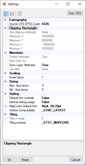
Note, the properties that are dimmed, are properties cannot be set by the user. However, in special cases, the manufacturer may send a metadata file that updates these properties.
The settings are grouped in the following categories:
| Category | Meaning |
|---|---|
| Cartography | Properties that are deals with the mapping attributes of the data |
| Clipping Rectangle | Set of properties that forms a clipping region, in which the layer can be displayed. |
| Metadata | Additional information that is saved along with the mapping data, used by application for getting further information about the layers. |
| Scaling | How to scale the data. |
| Sizing | Sizing attributes and limitations. |
| Styling | Styling attributes. |
| Tiling | Tiling arrangement of the data. |
Modifiable properies
The following properties are modifiable:
Source CRS EPSG Code (Cartography) - the source map coordinate system. The user may set a code (named EPSG code) that specify the coordinate system. The default (4326) is a geographical WGS-84 which is a commonly used coordinate system. This is also the coordinate system that the output layer will be converted to1. If assistance in getting the EPSG code is needed, a click in the Find CRS button will open a form that will help the operator find the proper EPSG code.
Scale factor (Scaling) - A factor used applications to convert 1:1 pixel ratio size to the map world's scale (for example 1:50000 will be set as 0.00002).
Min size factor, Max size factor (Sizing) - Used to limit scaling depended object sizing when upon scale changes.
Internal styling usage (Styling) - Treat the data source as if it has internal styling. The schema attachment to the layer will disabled the layer will be converted using it's internal styling data. KML/KMZ files do not need this property since the system set it temporary when opening this layer format.
Default font override (Styling) - For internal styling, override the default font with the provided one.
MapCore's default font (Styling) - For internal styling - the overridden default font. Pressing the ... button will open a font selection dialog box for user assistance.
Version Compatibility (Styling) - Backwards combability of the generated vector data.
Tiling scheme (Tiling) - The plan (scheme) used to tile the data in respect to earth. i.e. what is the tile size in pixels, How many tiles are covering earth in the lowest level of details and where the top left tile is situated. 4 possible values can be selected2
- MapCore - Better for performance but, unique to MapCore's based applications only.
- Global Logical - Used mainly by Geo-Server WMTS servers
- Google CRS84 Quad - Used mainly by google earth
- Google Maps Compatible - Used mainly by google maps.
Selecting coordinate system (CRS)
From the settings property dialog, click the Find CRS button. The following dialog will be popped up:
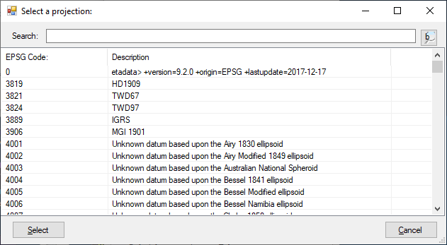
- You may scroll to the desired coordinate system.
- You may a fill portion of the code, or description and click the search button

- As a result the first line containing the data will be presented at the top of screen.
- Additional click on the button will scroll to the next line containing the data and so on.
- Once navigated to the desired coordinate select it and click select
- The dialog will be closed and the
Source CRS EPSG Codeproperty will contain the selected property.
- The dialog will be closed and the
- The operator may click the Cancel button, in this case the dialog will be closed without changing the
Source CRS EPSG Codeproperty.
Convert layers with internal styling format layers.
- Click the
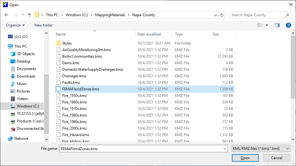
...button at the data source filed (in the main form). An open file dialog box will be displayed. - Select a KML/KMZ file type, navigate to the folder containing the data and select the file as shown bellow:
- Click open and the file layers will be displayed:
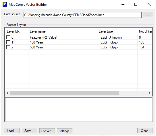
- Check the desired layers and click
convert:- A Browse for folder dialog will be popped up, to convert, select a folder and click
OK, clickingCancelwill cancel the conversion - Conversion will be conducted. At the the conversion a save file dialog will be popped up for saving the log file. Navigate to a folder click
Saveand save it. The layers will be saved under the folder selected in the Browse for folder dialog.
- A Browse for folder dialog will be popped up, to convert, select a folder and click
Installation and execution
As an external tool used in Mapabase-3.2.1.0
This version (7.11.4.0) is used as an external tool in Mapabase version 3.2.1.0. Therefore, installing Mapabase will also install this tool.
It is executed from Mapabase in the following manner:
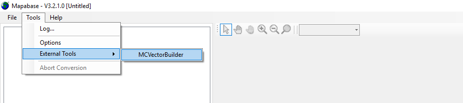
After activation the MC-Vector-Builder main form will be displayed.
Directly from desktop
Upon installation (or Mapabase installation), Right click the icon  then select "Run as Administrator". Note, you are not required to perform this step for every time you need to activate the vector builder, just after install it (or installation of
Mapabase).
Click the  icon - MC-Vector-Builder main form will be displayed.